AN NUR Integrated Survey
Hydrographic Survey Services
AN NUR Marine Services
Agency & LogisticSupport Services
Provision of Marine Spread
for Offshore Survey Operation
AN NUR Integrated Survey
Offshore Survey OperationSupport Services
Positioning & Construction
Survey Support
Geophysical Survey Services
Hydrographic Survey Services
Marine Environmental Services
Specialist Survey Operations
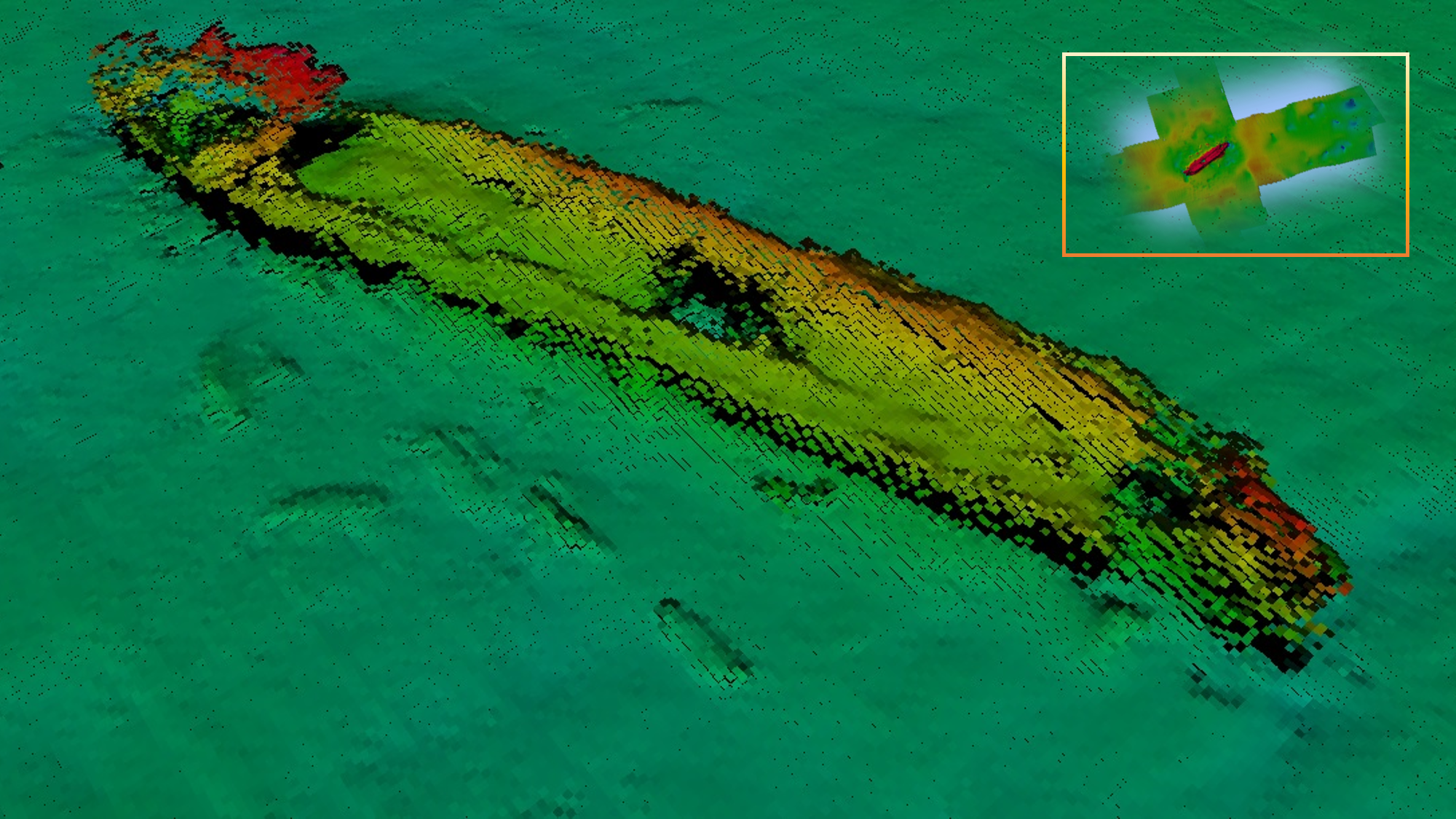
Our Hydrographic survey service utilizes our own fleet or suitable chartered third-party vessels which are mobilized with all systems to meet each project, such as single beam and multi-beam echosounder systems for hydrographic surveys and charting. Associated services include environmental impact studies and burial assessment surveys. We support a variety of activities that include river profiling, flood risk assessment, port and harbor maintenance (dredging), coastal engineering (beach erosion and replenishment studies) as well as coastal zone management. Water depth can be obtained by physically dipping, echo sounding (single or multibeam), addition systems can be utilized such as a side scan sonar to further enhance the dataset.
Our range of services include:
Hydrographic Survey and Mapping – we offer precise and industry recognized acquisition techniques and methodologies
to deliver data of exceptional quality in all water depths from the shoreline to Offshore.
Port, Harbors, Utility Installations and Coastal Survey - we offer innovative and robust data acquisition, processing systems and methodologies
to deliver data of exceptional quality in all water depths