AN NUR Integrated Survey
Geophysical Survey Services
AN NUR Marine Services
Agency & LogisticSupport Services
Provision of Marine Spread
for Offshore Survey Operation
AN NUR Integrated Survey
Offshore Survey OperationSupport Services
Positioning & Construction
Survey Support
Geophysical Survey Services
Hydrographic Survey Services
Marine Environmental Services
Specialist Survey Operations
Our services include assistance in the design and execution stages prior to rig moves and the emplacement of offshore infrastructures such as hydrocarbon production facilities, pipeline routes and other civil engineering projects. Utilizing our owned and operated survey fleet, we are capable of acquiring multi-disciplinary and complimentary data sets in a single mobilization.
Our range of services include:
Rig/Platform Site Surveys and Geohazard Investigation
We offer a wide range of site survey options and take pride in being flexible with equipment specification to meet the needs of the client. A typical site survey solution includes but is not limited to:
Precision DGPS positioning and Navigation Systems
Bathymetry single beam or multibeam systems
Seabed object detection
Seabed shallow geology profiler data acquisition
High and Ultra-High resolution 2D Seismic
Seabed Magnetic anomaly detection
Seabed shallow soils sampling (CPT, Vibrocoring, Piston Coring, Box Coring)
Pipeline/Cable Route Survey:
Planning Pipeline/cable routes requires mapping of the seabed between landing points and from the shoreline to full ocean depth. In continental areas, cables are required to be buried where possible for protection from other marine activities. Our survey services provide essential information on water depth, seabed morphology and shallow geology/soil strength.
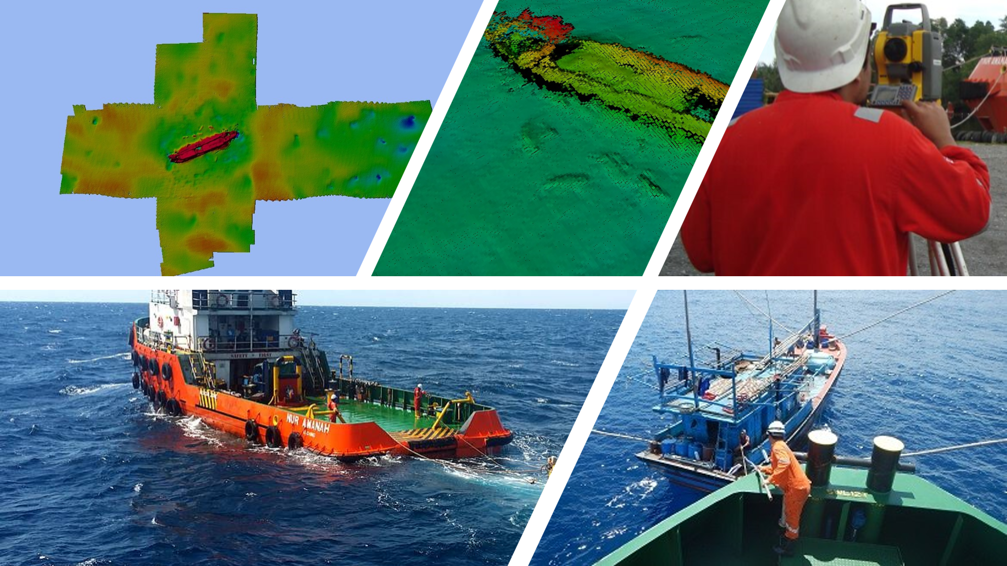
SEABED SURVEY:
Utilising a wide knowledge and understanding of systems and limitations AN NUR Integrated Survey offers a broad selection of acquisition systems to meet all requirements.
Side Scan Sonar – We provide services to acquire high quality Side Scan Sonar (SSS) data. SSS data is used to provide highly detailed imagery of the seabed and potential debris. With options to piggyback a towed magnetometer behind the side scan.
Sub-Bottom Profile We provide services to gather and provide high quality sub-bottom profiler (SBP) data, using pole mounted or towed sensors. Typical uses include detecting top layer thickness, pipe/cable detection, buried objects and customer geological and geophysical analysis.
Bathymetry We provide services to acquire high quality multibeam data utilising the latest systems available to ensure a highly detailed and accurate imagery of the seabed. With water column and backscatter data sets available to enhance the imagery and capture all features.
Data Processing, Charting and Reportin We support all elements of data acquisition, both during seabed mapping and route surveys. We offer data processing, charting and reporting of the acquired data and provide customers with the tools and personnel needed to perform data processing, either on-board the vessel or using our office facilities.
Data Processing, Charting and Reportin We support all elements of data acquisition, both during seabed mapping and route surveys. We offer data processing, charting and reporting of the acquired data and provide customers with the tools and personnel needed to perform data processing, either on-board the vessel or using our office facilities.
Inland and Shallow Water Survey:
We offer a complete solution to all inshore and shallow water surveys, from power station outflow and inlet surveys to river surveys. Our team will review the challenge and provide an effective solution with supply of all needed to complete the acquisition. Selecting the correct systems to maximise all data sets.